Thursday, August 24, 2017

Kazakhstan

As a Swiss citizen, I'm allowed to stay in Kyrgyzstan up to 60 days without visa. But I'm actually planning to stay 71 days there. So what do I do? I am actually allowed to exit and reenter the country as many times as I want. And the best part is: each time I get 60 fresh new days! Since Kazakhstan does not require any visa either, and is only 20 kilometers away from Bishkek, that solves my problem!

My cousin Eliane being already back in Switzerland, we went with Lilia and Milena for three days to Almaty, the cultural capital of Kazakhstan. From the Kyrgyz capital, it is a 4 hours drive in marshrutka (minibus).

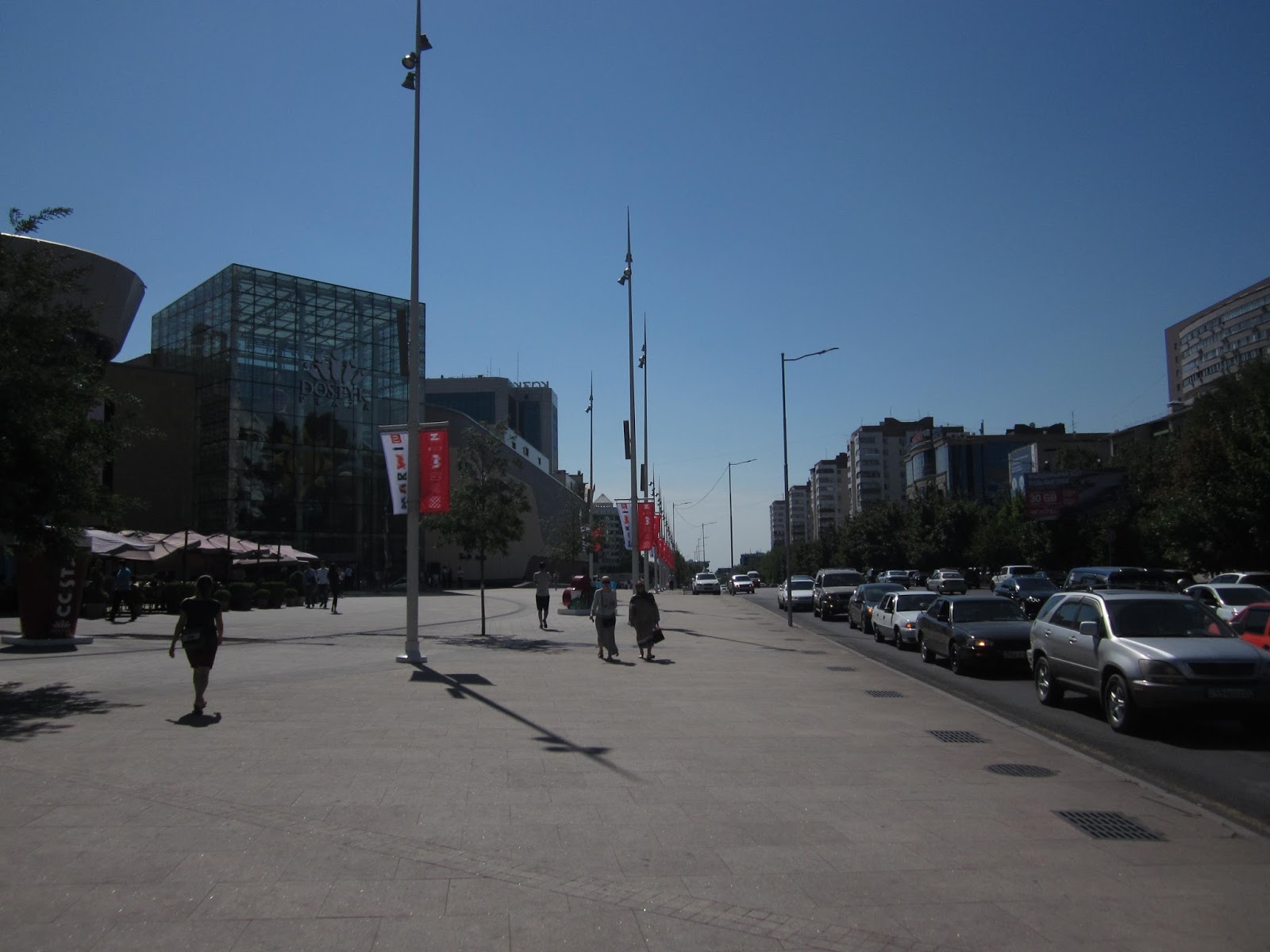
In Bishkek, one can still see and feel the soviet influence. Almaty however looks like a modern European city: large avenues, big malls, lots of shops, cafes, restaurants, clubs, etc.

 Welcome to Kazakhstan, or Good luck as they wrote at the customs.

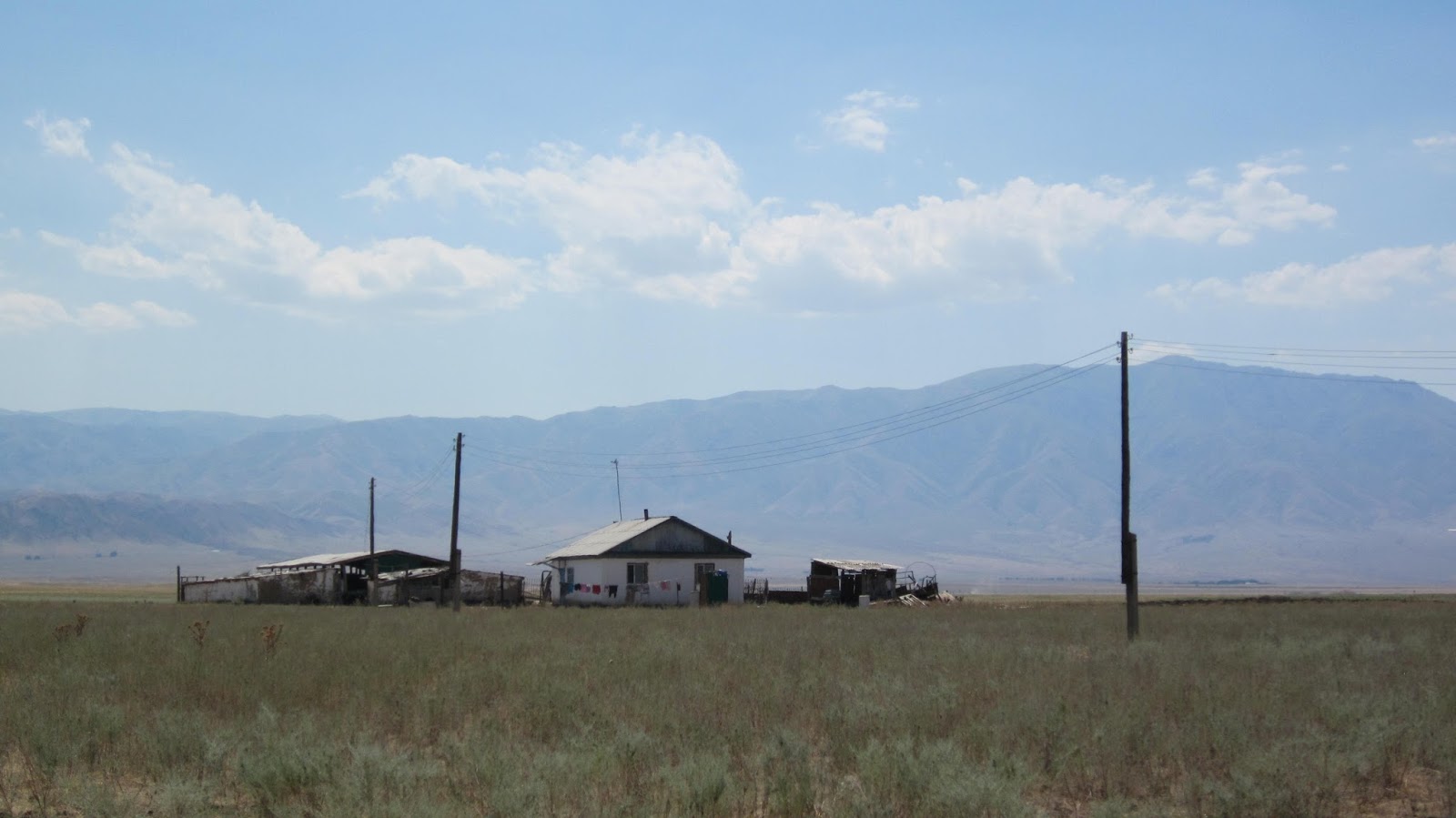
 After crossing the border, the Kazakh steppes replaced the Kirghiz mountains.

 Between the two cities, it is mostly uninhabited.

 Approaching Almaty, there are some villages again.

 Like Bishkek, the city is very green.

 Unlike Bishkek, there are some canals.

From the center, we took a gondola to Kok-Tobe, a hill overlooking Almaty.

 The view from Kok-Tobe.

 The Kazakh city is at the foot of the Ala-Too mountain range.

 In front of the Dostyk Plaza, a big shopping mall.

 Almaty is much more stroller friendly than Bishkek.

...except that currently there are roadworks in most avenues of the center.

 Ascension Cathedral, also in maintenance.

 The Central State Museum of the Republic of Kazakhstan.

 The Independence Monument.

Wednesday, August 23, 2017

Kyzyl-Oi

Before returning back to Bishkek and finishing our organized tour, we spent a last night in the small village of Kyzyl-Oi. When stopping at a gas station, the cashier asked me why we were going there, since - according to her - there is absolutely nothing to see in that place.

Well, she was clearly wrong. Whereas as usual in Kyrgyzstan the village itself does not have any sights, the nature around is stunning. Kyzyl-Oi is embedded between mountains (and probably get as much sunlight as the city of Glarus) with red/green colors that reminded me of Iceland.

We started the day hiking through a coal mine.

To reach our destination, we had to drive once again through a canyon, the Kökömeren Canyon.

Entering the Icelandic landscapes.

 Kyzyl-Oy, which means red hollow in Kyrgyz. I would rather have called it green hollow.

The main street of the village.

It is surrounded by colorful mountains.

In Central Asia, they have very impressive graveyards.

The graveyard overlooking Kyzyl-Oi.

The next morning, the weather was good again.

I went at the same place as the previous day to take pictures with a blue sky.

Lilia and Milena crossing the Kökömeren river.

Leaving Kyzyl-Oi driving further into the canyon.

To return to the north part of the country, we must cross the Töö Ashuu pass lying at 3200 meters.

Monday, August 21, 2017

Song-Kul

After Ak-Say and its impressive canyon, we left the Issyk-Kul region and drove toward another beautiful lake, Song-Kul. The second biggest lake of Kyrgyzstan lies at an altitude of 3000 meters. 

Beside a few ruins that had been built by fishermen, there is no permanent infrastructure. The steppes surrounding the lake are occupied between June and September by a few herders, some yurts camp for tourists, and a lot of horses, sheep and cows. The rest of the year it is uninhabited as it get extremely cold. We spent two nights in yurts, one on the south shore and one on the north.

The lake is only reachable through some dirt roads in bad condition, or at least the upper part of them. The first part of the road we took also leads to the Torugart pass, one of the opened border with China. The Chinese actually finance and built the roads themselves so that they can send their trucks full of goods to be sell in Bishkek.

Some Chinese trucks on a brand new Chinese road.

The pass to Song-Kul (not of interest for China).

The dirt road climbs up to about 3300 meters.

At the top I was very disappointed that there was no sign with the altitude.

After crossing the pass, we finally can see the lake and the first yurts.

Our first yurt camp.

Our beds.

The camp expected 70 persons the next day. 
They had to build a few more yurts (and kill a horse to feed them).

There a many yurt camps for tourists.

We rent some horses and made a tour around the camp.

My horse always wanted to eat.

Our guide Talant demonstrating his horse riding skills.

I finally got to try kumis, the fermented mare's milk. I barely managed to finished my cup...

The water was not so cold, considering the altitude of the lake.

By the way, all the white flowers are edelweiss.

Leaving the camp and the family that runs it.

Driving to the north shore for another night.

Crossing the river that flows from the lake.

Milena was laughing each time she could see animals from the car.

Our camp on the north shore.

We were the only one without bike.

I climbed a small hill to have a scenic view over the lake and our camp.

And over the south short were we slept the day before.

I made some new friends on the way. They all three ride together on the same horse. They said they already were 5 on a single horse...

Time to sleep. With a few blankets, the nights were not too cold.

When leaving Song-Kul, we climbed a pass... and drove back on the same side.

I realized our guide brought us there only so that I can have a picture with the altitude sign.